The Long Way Home
Story by John Parker
Commuting to and from work can be a real hassle, what with the traffic congestion, or the long boring drone on the super slab. Or....it can be so much more.
As I was putting on my riding gear in preparation to leaving work this morning, I had channel 222 (L.A. Traffic Reports) on the XM radio.
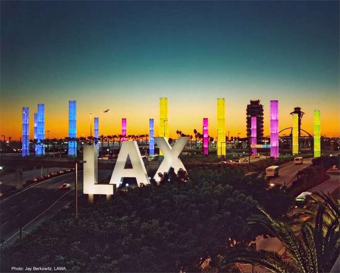
The digital voice that poses for a reporter was saying that the commute this morning was already "congestion yellow" with various slow downs and delayed travel times from point to point. It didn't matter to me this morning, as I was taking the "long way" home. As I punched the "0" button on the Roady, and switched to "Top Tracks" channel 46, I ran though this morning's route in my mind. My home, in the San Fernando Valley, is 22 miles from my work location at LA International Airport.via the I-405. My usual route takes me nowhere near the I-405. My normal ride into work, at 4 a.m. each duty shift, is through Topanga Canyon in the Santa Monica Mountains. A distance of about 40 miles with 20 miles of twisties and 10 miles along the Pacific Ocean on Pacific Coast Highway (PCH). My route home always begins with a ride north on PCH, then up one of the canyons through the Santa Monica's to the Mother Road, Mulholland Highway, to ride the backbone of the mountain range to home.
As I cruised through Marina Del Rey with it's multi-million dollar condos and matching yachts, then along the beach through friendly (but weird ...even for L. A.) Venice Beach, I checked my outside temp gauge. It registered 78 deg. I checked my ST1100's clock; it was 6: am. Ah! this is why Southern California is so crowded...Phfuttttt! I road down the "Incline" to merge with light traffic on PCH while keeping a careful watch for the ubiquitous Santa Monica City Motor Cop. Eight times out of ten, he and his partner are "working" the commuter traffic as it transitions from the high speed I-10 to the 45 mph PCH in "His City". They have lots of creative hiding spots, but I've found them all with the help of Mr. Valentine over the past 14 years that I've used this route to and from work. No surprises this morn'. Leaving PR of Santa Monica behind, I cruised smoothly north on PCH through the "Rich & Famous" communities of Malibu and Point Dume`. As PCH dropped down off the bluffs at Zuma Beach, I noticed how perfectly flat the ocean was today. Not too many surfers "fur shure dude." I let "Blue Thunder" have her head as we motored though the sleepy little town of Trancas, with it's ever popular Starbucks packed with bleary-eyed commuters getting their last caffeine fix before joining the crowds heading south to the Megalopolis. I motored on by. No need for me to join that scene. I passed by Bob Dillon's beach house and rode on past the artist communities of Encinal Bluffs and Nicolas Beach while "Mr. Tambourine Man" played on the Roady. Cooool! My thoughts flashed back to the 70's, when Becci and I would haul or "twin 72s" down to the beach here, and Scuba dive for lobster and sheepshead in the secluded coves.
By now I had already passed several of my usual turn offs. Of the canyons that I regularly use to connect with the "Mother Road," Latigo Canyon is one of my favorites. Mainly because it consists 626 turns in a little over 12 miles. I know that road like my own backyard, probably better. It is also a favorite of the weekend sport bikers who frequent the Rock Store. There are lots of tight turns between the "Store" and PCH with finely ground particles of motorcycle. My ST1100 "Blue Thunder" and CBR1100XX Blackbird "Silver Bullet" have left their share of m/c DNA along there, as well, over the years. Two especially exciting decreasing radius turns greet the nimrod who gets lackadaisical in the uphill direction. Lots of the human hormone "Motocycling" has been excreted in these canyons by bikers of all kinds. It is my good fortune to be able to ride these snaky strips of grippy asphalt during the times when they are virtually deserted. It is very rare to see the "squids" up here at 4 a.m. or even 6-7 a.m., like today. I rode on past the canyons of Encinal and Decker. Too soon to turn off. Many times I ride on up to Point Mugu State Beach to ride the primitive Deer Creek Canyon Rd. This is little more than a paved driveway, but the views are breath taking, as it climbs from the beach to over 2000 feet in several miles. It is not uncommon to be able to view Catalina, Anacapa, and Santa Cruz islands at the same time while riding this road. On occasion, I will continue on up PCH past Point Mugu Navel Air Station (Pacific Missile Test Site), through the bustling beach community of Oxnard, to points north. I have been known to ride to San Francisco for Lunch and turn around and ride home for dinner.
This morning, as I entered the popular surfing spot and movie making location of Leo Carrillo State Beach, or "County Line" as it is called by surfers, I turned my backside to the ocean and headed into the mountains on Mulholland Highway. I left the movie locations of "Beach Blanket Bingo" and "Gidget" and joined the "Mother Road" as she took us through some of the most remote, cycle happy, country to be found near a major metropolitan area. The road is curvy, the houses are sparse, and the scenery is sometime "other worldly" (the Santa Monica Mountains Space Tracking Station adds to this ambiance). I motored past the tops of all of the canyon roads that I passed the bottoms of on PCH an hour earlier. The temps were 30-35 degrees cooler in the canyons than the 78 deg. that I had experienced along the beach. Shortly after crossing Kanan Rd., as I dropped into the Seminole Hot Springs area near Cornell, and carved the tight tail touching twisties leading into and past the Rock Store, my air temperature gauge read 43 deg. This was not unexpected, as I see temps into the 20's many times in the winter during my morning commute through this area. I cranked a little heat into my Hot Grips® and smiled broadly as the Metzlers® bit fiercely into the toothy tarmac, and I knifed through the "technical" sections on my way to the San Fernando Valley. Pink Floyd, Guns 'n' Roses, and the Police played forcefully through my ER-6's helping me keep my "rhythm" as I railed the right hand sweeper at Cornell and tooled past the ritzy community of Malibu Lake. Once past the 4-way at Lake Vista and into the Malibu Creek State park, it is one perfectly banked sweeper after another.
All too soon I reached the first traffic signal in over 50 miles this morning at Las Virgenes Rd (Malibu Canyon). I waited while my "Traffic Light Trigger-LESS" ST gallantly tried to activate the buried sensor coils, and get the light to turn green. Las Virgenes, at this time of the morning, is bumper to bumper with L.A. commuters trying to bypass the parking lot-like 101 and 405 freeways into the city. There's not much opportunity for me to "bust the light" ("Honest Officer, the signal was malfunctioning!"). This morning, the light turned green for me in an uncharacteristically short amount of time, and I was able to continue south on Mulholland Highway toward home. Traffic was still very light for this close to the city, but a hindrance to efficient travel none-the-less, so I settled back into my cruisin' mode and went with the flow. I exited "The Mother Road" at Topanga Canyon and joined the rest of the frowning morning commuters on their way to WORK. I was smilin' inside my Schuberth though, as I had just enjoyed an hour and a half of motorcycling Valhalla on my way HOME!